


From The Trussville Tribune staff reports
BIRMINGHAM (NWS) — The risk for severe weather in parts of Alabama has been increased, according to the National Weather Service in Birmingham.
Meteorologists say environmental conditions today and tonight are favorable for tornadic supercells. A new severe squall line has developed over the AR-KA-LA-TX region could serve as a lift for storms in our area. This system is ahead of a Pacific front/dry line that will be the primary source of lift, which combined with rising temperatures, will give us the potential for showers and thunderstorms.
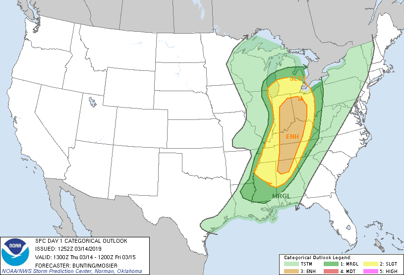
National Weather Service Convective Outlook
The supercellular activity is expected this afternoon. There is still some uncertainty in the forecast, but the National Weather Service believes there will be significant coverage of showers and storms, with an enhanced risk in our far northern counties. Models show the slight risk has been expanded eastward based in instability and storm motions.
Dry air is also giving us the potential for isolated pockets of damaging winds and quarter-size hail. A wind advisory has been issued.
The severe weather threat is expected to end by 1 a.m., but that could change so be sure to stay weather-aware.

