


From The Trussville Tribune staff reports
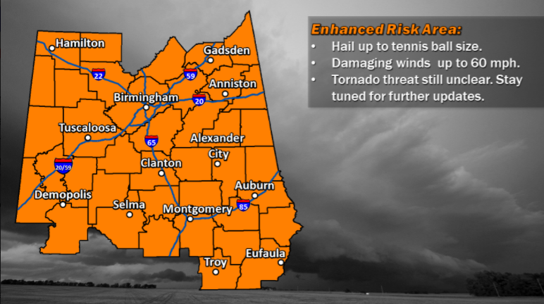
TRUSSVILLE –According to the National Weather Service, severe thunderstorms are likely across central Alabama on Monday. The area of concern includes Jefferson, St. Clair, and Blount counties.
The enhanced risk area could include up to tennis ball size hail and damaging winds of up to 60 mph. The tornado risk is unknown at this time, but will be updated as the system approaches.
 “The warm front will be pulled northward on Monday morning, powered by a low pressure system moving from Missouri into Kentucky. Scattered showers and storms will accompany this passage,” according to Bill Murray of Alabamawx.com. “A warm and humid airmass will be in place south of the warm front, and some sunshine will push temperatures into the upper 70s. I don’t think it will have a typical stormy feel, with a lack of strong surface winds. But there will be a good supply of instability, decent wind shear and very strong temperature decreases with height. A line of thunderstorms will enter the state during the late afternoon or early evening and will intensify through the evening hours as it pushes southeastward.”
Murray said the tornado threat will be determined by atmosphere instability on Monday.
“There is high confidence that large hail will be a significant threat,” Murray said in the Alabamawx.com blog. “There is less confidence about the tornado threat. If the NAM is correct, instability will be about 30% higher and wind shear about 30% higher also. This would greatly enhance the tornado threat. As the surface low moves eastward, it will drag a cold front into Alabama.”


