


From The Trussville Tribune staff reports
BIRMINGHAM — There remains a slight possibility of severe storms throughout the Birmingham metro area this afternoon, the National Weather Service of Birmingham said.
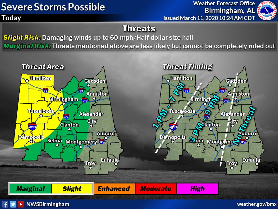
In an updated model, the National Weather Service said that a marginal to slight risk of storms could impact central Alabama between 3 to 9 p.m. on Wednesday. The models could very well change as the day progresses, however.
This complex of storms over AR is what will bring a threat of strong to severe storms to portions of Central AL later today. #alwx pic.twitter.com/MEdTedcgo6
— NWS Birmingham (@NWSBirmingham) March 11, 2020
The scattered storms could bring winds of up to 60 MPH along with quarter-sized hail. Western Alabama is most likely to see the brunt of the storms. The threat of tornadoes is low, per the weather service.
“There is still uncertainty in the exact track of the thunderstorm complex because even the high resolution models struggle with the evolution of these type of systems,” the National Weather Service of Birmingham said. “Therefore, please check the forecast frequently throughout the day as changes become necessary.”


