


From The Tribune staff reports
BIRMINGHAM — Alabama is in store for yet another round of storms as the National Weather Service in Birmingham has predicted a severe weather risk for this upcoming Sunday.
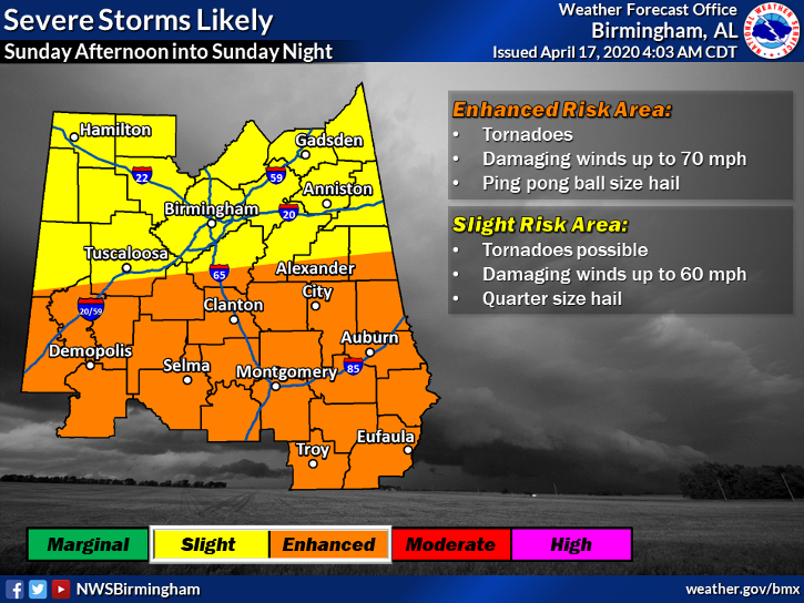
The National Oceanic and Atmospheric Administration has placed most of Alabama in an enhanced risk of severe storms beginning Sunday afternoon and throughout the night.
“Severe storms are likely Sunday across the Gulf Coast states,” the NOAA summarized. “The greatest threat appears to be from Louisiana to Georgia, with significant severe storms expected including tornadoes and damaging winds. Large hail is likely as well.”
The National Weather Service’s models show that the greatest risk for strong storms currently remains south of Birmingham and Tuscaloosa, but that depends on how far north the warm front slides. The NWS said that a warm front will slide north from the Gulf Coast, which will place portions of the state at risk for supercell storms. If the area of low pressure trends more to the north, the severe threat will increase for the central portion of the state.
The greatest concern Sunday will be the chance for heavy rain, strong winds, tornadoes and hail.
The majority of locations could pick up 1-3 inches of rain, but there’s a chance that some places could see up to 3-5 inches.


