From The Tribune staff reports
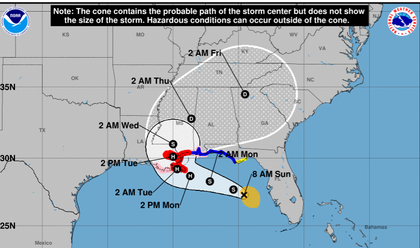
BIRMINGHAM — Tropical Storm Sally is in the northeast Gulf of Mexico as of Sunday morning and is expected to reach hurricane strength before making landfall in Louisiana on Tuesday, according to the National Hurricane Center.
Sally is expected to continue west northwest along the northern gulf shoreline before making landfall near Houma, LA on Tuesday. After making landfall, the system is expected to make a turn to the northeast and follow a track through Mississippi and into central Alabama.
The most recent models from the NHC show the center of the disturbance impacting the metro Birmingham area on Thursday as a tropical depression. The system could bring high winds and heavy rain as it passes through.
Heavy rains and storm surge from the Louisiana coastal area through the Mississippi and Alabama gulf coast and stretching into the Florida panhandle are expected as the system moves along the coast and makes landfall.
The National Weather Service in Birmingham is forecasting rain chances of 60% on Wednesday and rising to 70% on Thursday with thunderstorms possible in the Tribune coverage area.


