


From the Tribune staff reports
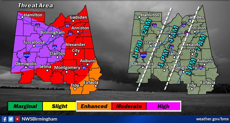
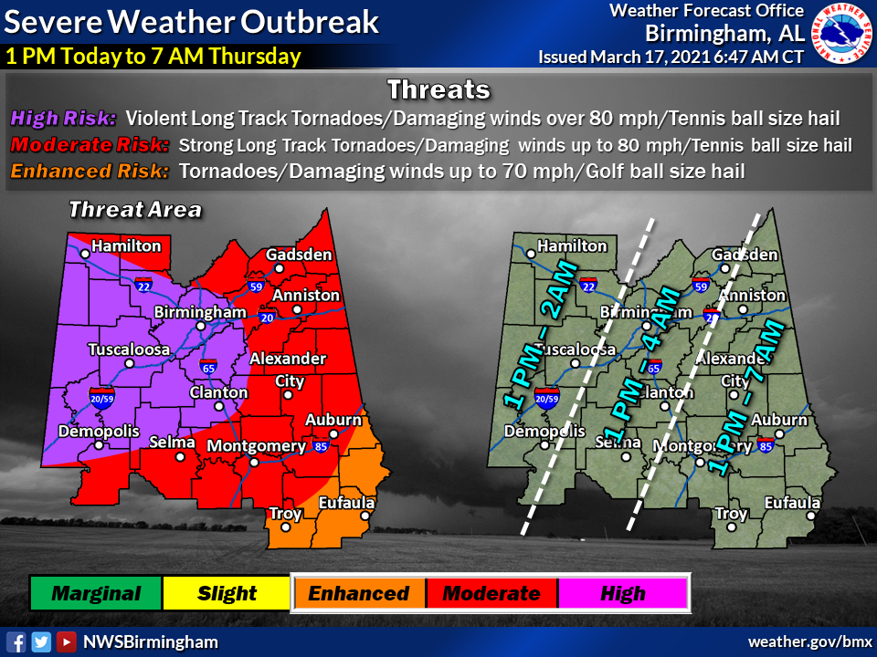
BIRMINGHAM — According to the National Weather Service in Birmingham, Jefferson County, including much of the Tribune coverage area, is now in the highest risk (5/5) category for potentially severe storms on Wednesday.
These storms could produce violent long track tornadoes, damaging winds of up to 80 mph and tennis ball size hail. Additionally, storms could produce torrential downpours that could cause localized flash flooding. Conditions will be most severe locally from about 1 p.m. Wednesday until 4 a.m. on Thursday.
Citizens are advised to have multiple forms of weather alert systems and an easily accessible safe place or storm shelter. Charge laptops computers, tablets and cell phones in advance of 1 p.m. Make sure you know how to turn your cell phone into a hotspot in case of a loss of electricity.
The Tribune will continue to monitor the weather and provide updates here. Please check back often. You can contact us to notify us of conditions in your area by messaging us on facebook or by emailing us at news@trussvilletribune.com.


