


From The Tribune staff reports
BIRMINGHAM — A Winter Advisory issued for North and Central Alabama will go into effect at 6 p.m. on Sunday, January 2, and will be in effect until 3 a.m. Monday, January 3.
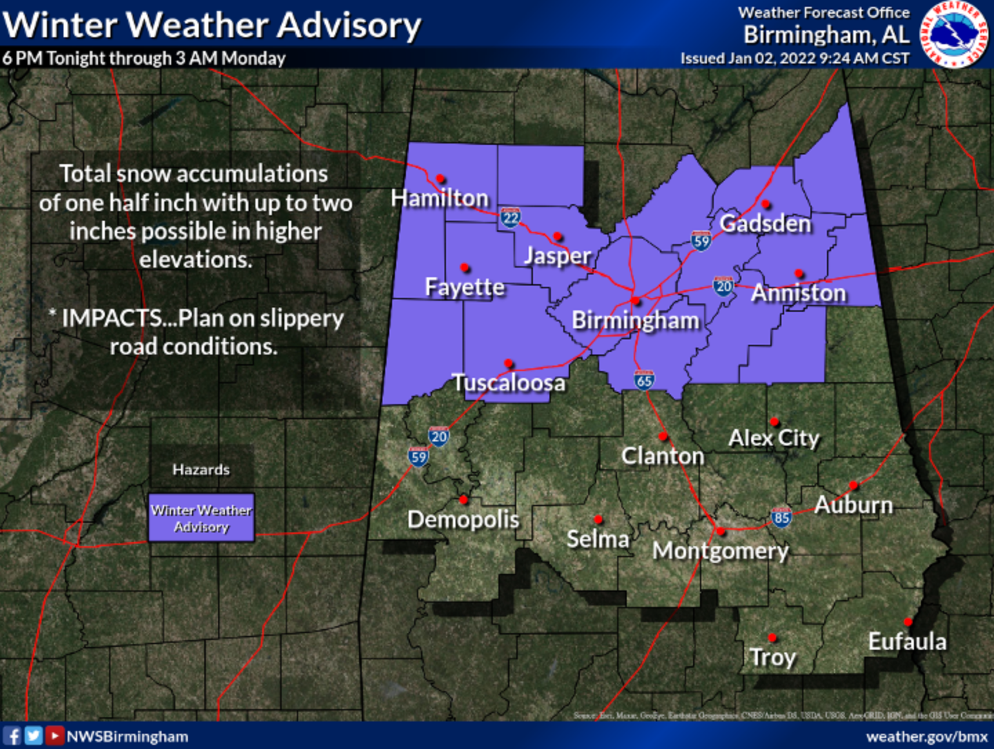
Photo courtesy of weather.gov/bmx
According to AlabamaWx.com, a Winter Weather Advisory includes Blount, Cherokee, Etowah, Fayette, Lamar, Marion, Walker, and Winston. The temperatures will be tumbling downward throughout the day, with the warmest temperatures you are going to see happening earlier, shortly after 12 a.m.
“A surface low has set up on the backside of this front that will bring more showers to the area later into the day, but with the influx of colder air, we will see the rain changing over to snow over the extreme northern and northwestern counties tonight before the precipitation ends,” Scott Martin with AlabamaWx.com said.
Martin explained that lows across the area tonight will drop into the mid-20s to the mid-30s.
“Slippery road conditions may develop this evening through the overnight hours once the temperatures drop below freezing, so please slow down and use caution if having to travel,” Martin said.
Rain will change to sleet and snow this evening over the Northwest Corner of Alabama first, around 5 p.m. Then, the precipitation will gradually change to sleet and then snow for areas north of US-80 from Demopolis to Prattville to Auburn.


