


From Tribune staff reports
BIRMINGHAM — After a brief appearance Tuesday in the local weather forecast from the National Weather Service in Birmingham, snow chances disappeared from the Tribune area outlook. But on Friday morning those chances of the white stuff, small as they may be, returned to the forecast.
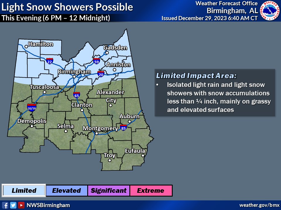 In parts of Alabama further north, the northeast corner is poised to see the most snow.
According to NWS, there is a chance of sprinkles and 10% chance of snow flurries before 9 a.m., then a chance of sprinkles after 1 p.m. Cloudy, with a high near 45.
Tonight, there will be a chance of rain showers and 20% chance of snow flurries before 1 a.m., then a chance of flurries between 1 a.m. and 4 a.m. and a low of around 31. The chance of precipitation is 20%.
Little or no snow accumulation is expected. Temperatures on Saturday are expected to reach 46 degrees.
Further, to northeast Alabama, reside the best chances for snow. The NWS said that Mentone in DeKalb County has a 20% chance of snow before 3 p.m., then a chance of rain and snow between 3 p.m. and 4 p.m., then a 50% chance of snow after 4 p.m. with a high near 38. Little or no snow accumulation expected.
Tonight, Mentone has 50% chance of rain, snow, and freezing rain before 4 a.m., then a chance of snow between 4 a.m. and 5 a.m., then a slight chance of rain and snow after 5 a.m. and a low around 31. Chance of precipitation is 50%.
New snow accumulation of less than a half inch possible. Saturday will see a 20% chance of snow, mixing with rain after 9 a.m., then gradually ending.


