


From Tribune staff reports
BIRMINGHAM — The National Weather Service in Birmingham forecast for the next 48 hours has a chance of a little bit of everything for Alabama. Here in the local Tribune coverage area, that includes a lot of rain, high winds and a chance of snow flurries on the back end of the system.
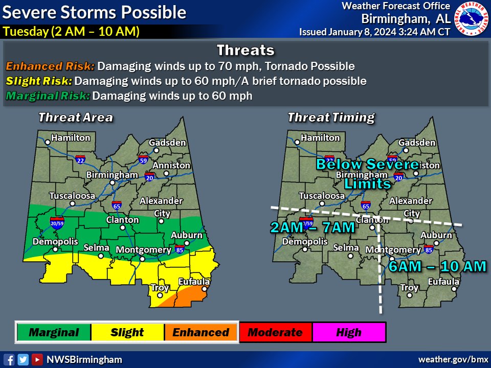
 Further south, there will be the chance of tornadoes while parts north will have a better chance of snow.
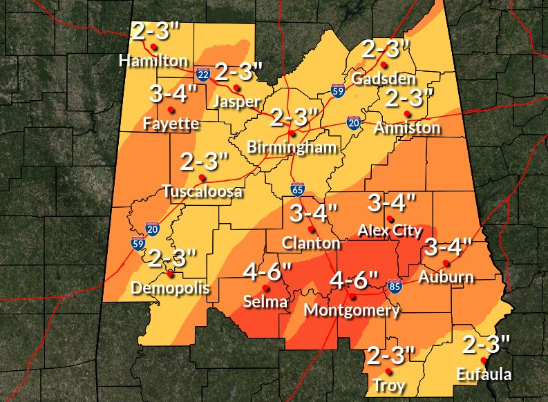
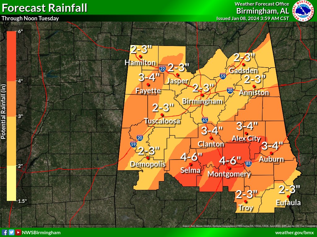
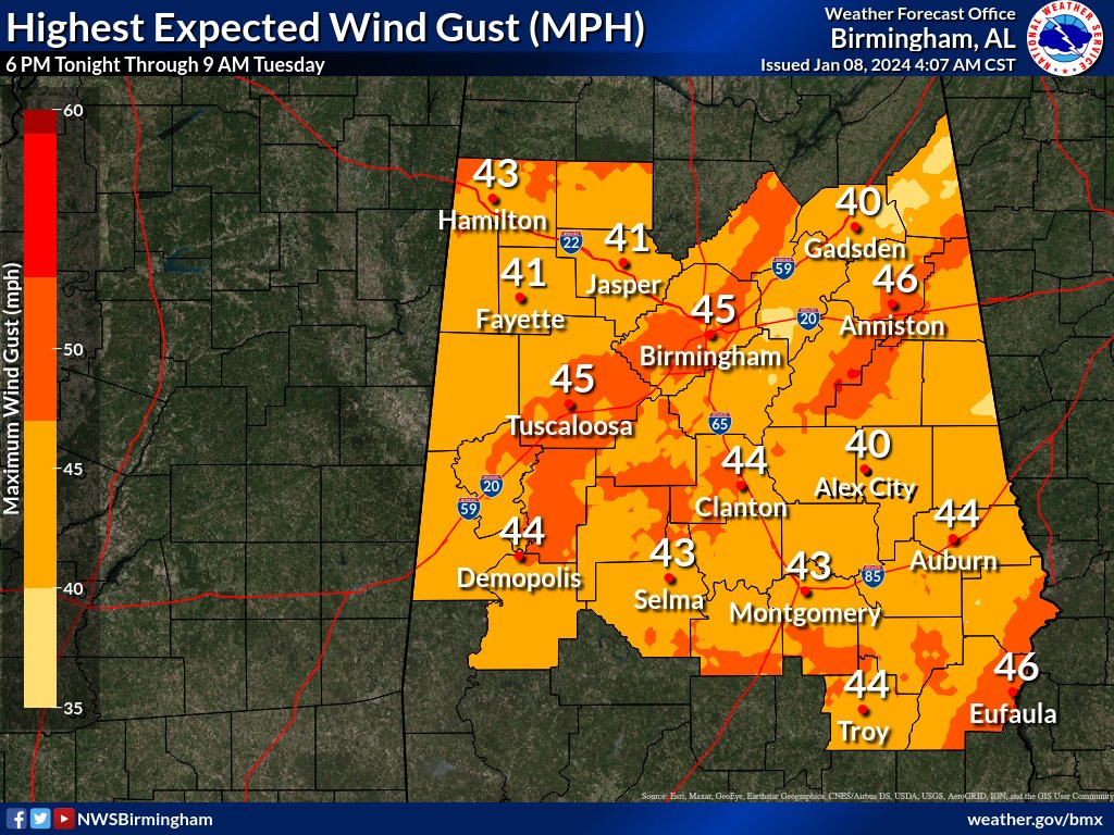
Tonight, we’ll have showers and possibly a thunderstorm in the local area. Some of the storms could produce heavy rainfall. The low should be around 49. Windy, with a southeast wind 15 to 25 mph increasing to 25 to 35 mph in the evening. Winds could gust as high as 45 mph. Chance of precipitation is 100%. New rainfall amounts between two and three inches are possible.
Tuesday, we’ll see showers before noon, then a slight chance of showers after 3 p.m. Temperature will fall to around 47 by 5 p.m. Breezy, with a south wind 15 to 25 mph becoming west in the afternoon. The chance of precipitation is 80%. New precipitation amounts between a half and three quarters of an inch possible.
Tuesday night, a slight chance of rain showers before 9 p.m., then a slight chance of snow showers between 9 p.m. and midnight. Mostly cloudy, with a low around 32. Breezy, with a west wind 10 to 20 mph, with gusts as high as 30 mph. Chance of precipitation is 20%. Little or no snow accumulation expected.


