


From Tribune staff reports
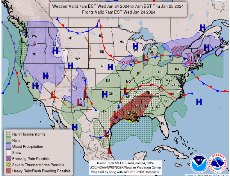
BIRMINGHAM — A flood watch has been issued by the National Weather Service in Birmingham for much of Alabama, including Jefferson and St. Clair counties. The flood watch begins at noon Wednesday and remains in effect through Thursday evening.
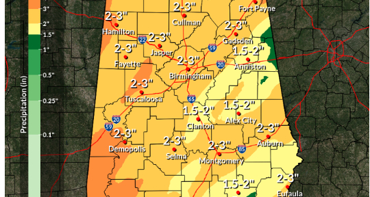
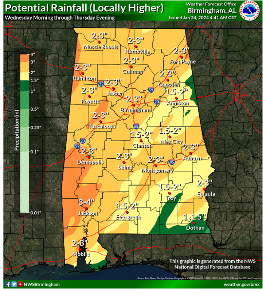 The Tribune area can expect waves of rain to pass through on Wednesday and Thursday. Rains could be especially heavy at times and totals are expected to reach 2 – 3 inches by Thursday night.
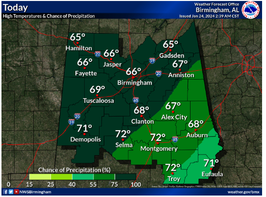
Today, there is a chance of showers, then showers and possibly a thunderstorm after 9 a.m. High near 66. Southeast wind 10 to 15 mph. Chance of precipitation is 90%. New rainfall amounts between a half and three quarters of an inch possible.
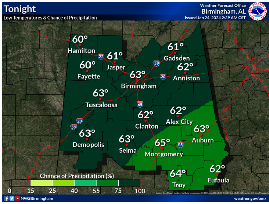
Tonight, showers continue and possibly a thunderstorm. Low around 61. South wind around 10 mph. Chance of precipitation is 100%. New rainfall amounts between 1 and 2 inches possible.
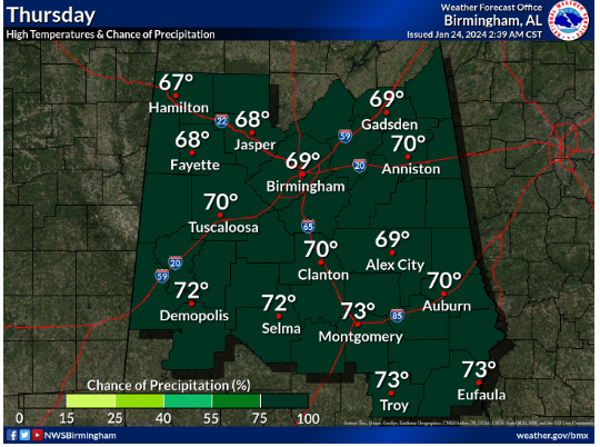
On Thursday, expect showers and possibly a thunderstorm. High near 68. South wind 5 to 10 mph. Chance of precipitation is 100%. New rainfall amounts between three quarters and one inch possible.
On Thursday night, more showers and possibly a thunderstorm. Some of the storms could produce heavy rain. Low around 59. South wind around 5 mph becoming west after midnight. Chance of precipitation is 80%.
Even as the flood watch ends on Thursday evening, rain chances remain at 70% on Friday and 89% on Saturday.


