


From The Trussville Tribune staff reports
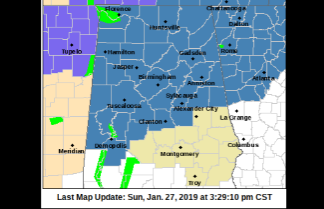
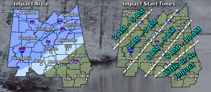
TRUSSVILLE — The National Weather Service in Birmingham has issued a winter storm watch for much of the northern half of Alabama, based on the likelihood of snow and freezing temperatures on Tuesday. The watch includes and is north of a line from Linden to Clanton to Wedowee.
The winter storm watch area includes Jefferson, St. Clair and Blount counties. The watch is in effect from late Monday night through Tuesday morning.
Related story: Monday Update: Winter storm warning issued, projection of snow amounts increase
 The watch means that there is the potential for snow, sleet, or ice that could impact travel conditions. Drives should expect dangerous and hazardous road conditions, which could impact morning rush hour.
According to the statement from NWS, a strong cold front will move into central Alabama late Monday night and Tuesday morning.
Rain will change over to snow as early as midnight Monday night in the northwest, with the rain-to-snow transition line moving southeastward through the morning on Tuesday. Snow will come to an end around noon on Tuesday.
While snow will only fall for a couple hours at a given location, it may be heavy at times, resulting in accumulations of 1 to 2 inches with isolated higher amounts.
Temperatures will also fall below freezing as the snow falls Tuesday morning, which may result in difficult travel conditions even where accumulations are less than 2 inches. This will impact the morning commute, especially along the Interstate 20 corridor.


